Exploring AI solutions to enhance school safety with real-time response and ethical design.
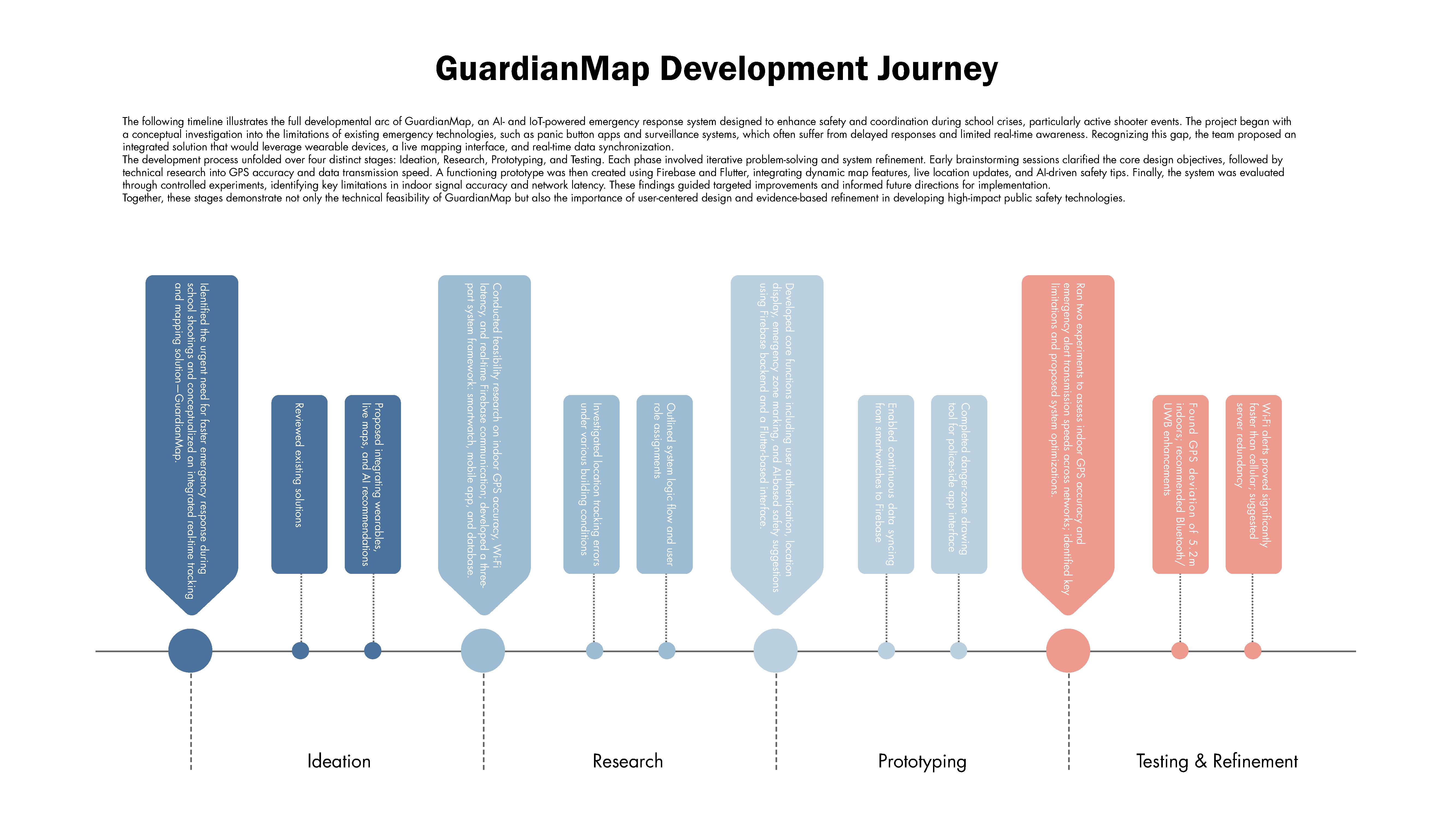
This research paper investigates how artificial intelligence can improve emergency responsiveness to school shootings. Through comparative analysis, system design, and real-world testing using GuardianMap as a prototype, the project demonstrates how timely alerts and spatial tracking can be optimized with AI.
Role
Researcher, Developer
Methodologies
Comparative Analysis, System Design, Firebase Testing, Algorithm Implementation, Data Visualization
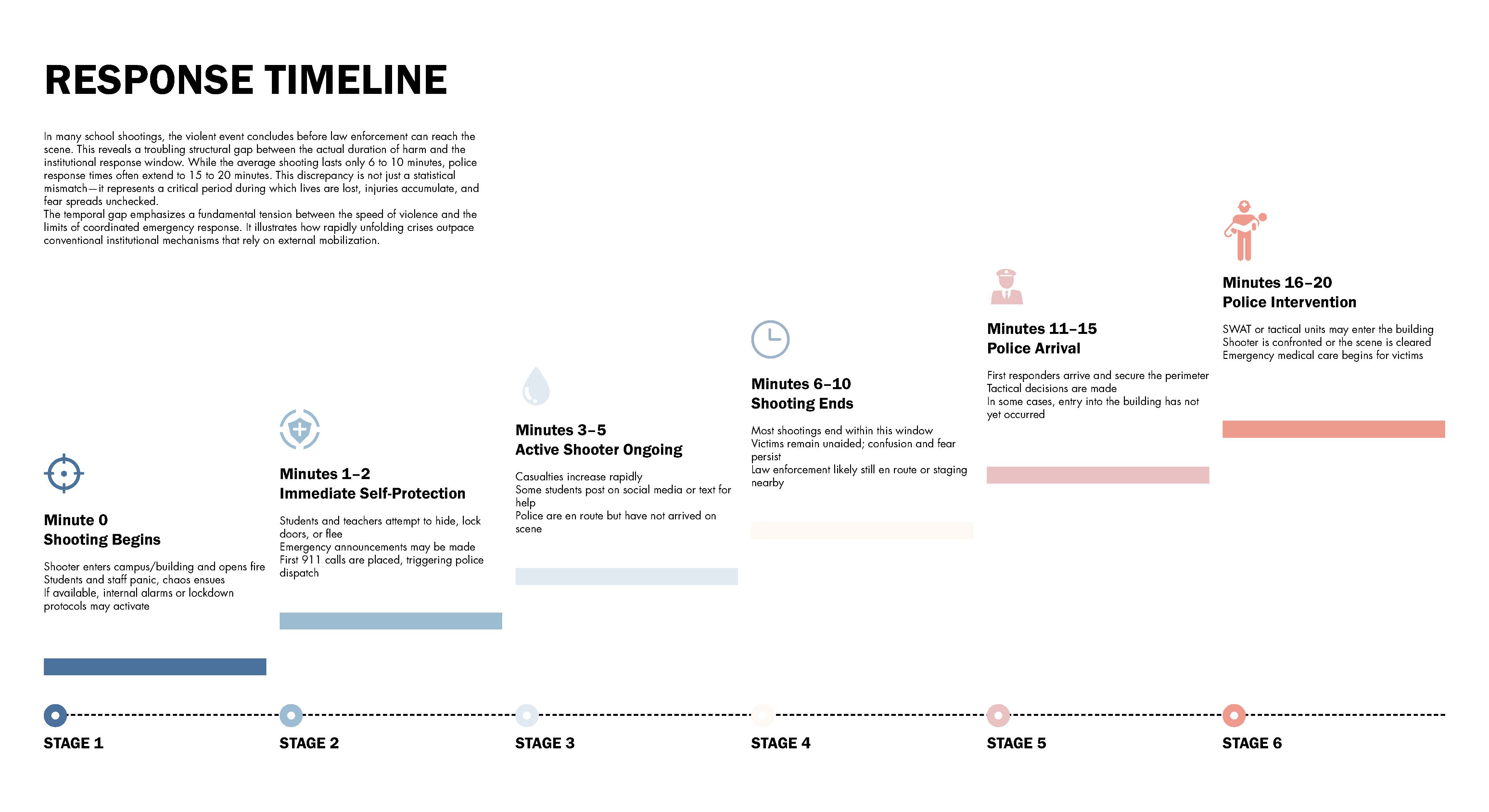
Mass school shootings remain a pressing public safety crisis in the U.S., with response delays often costing lives. In 2024 alone, 314 incidents occurred in K–12 schools. I was shocked by how long it often took for first responders to react. Most solutions like panic buttons or surveillance systems were either too slow or lacked real-time tracking. I began asking: Could wearable tech and AI make emergency responses faster and smarter?
This question inspired me to design a new system that could bridge the gap between detection and coordinated response in high-stress school environments.
To bring GuardianMap to life, I designed a full emergency workflow—from login to real-time police response. I used Firebase Authentication for user access and GPS-enabled wristbands to send student locations to a live map interface.
When an emergency is detected, the system automatically sends alerts to authorities, allowing teachers to guide students while police respond. I mapped and tested each stage—tracking accuracy, user interface, and alert timing—to ensure the system works smoothly in real-life situations.
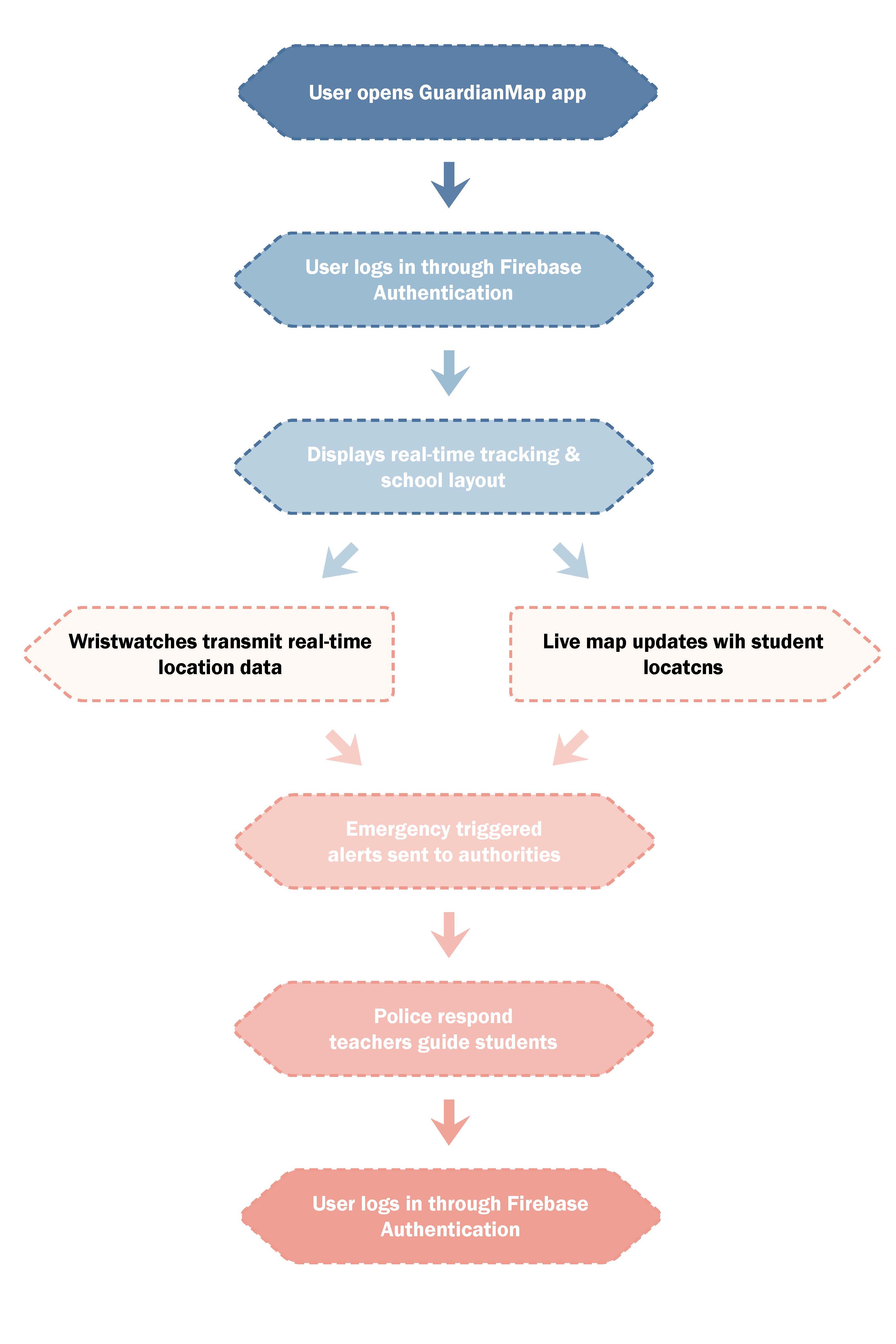
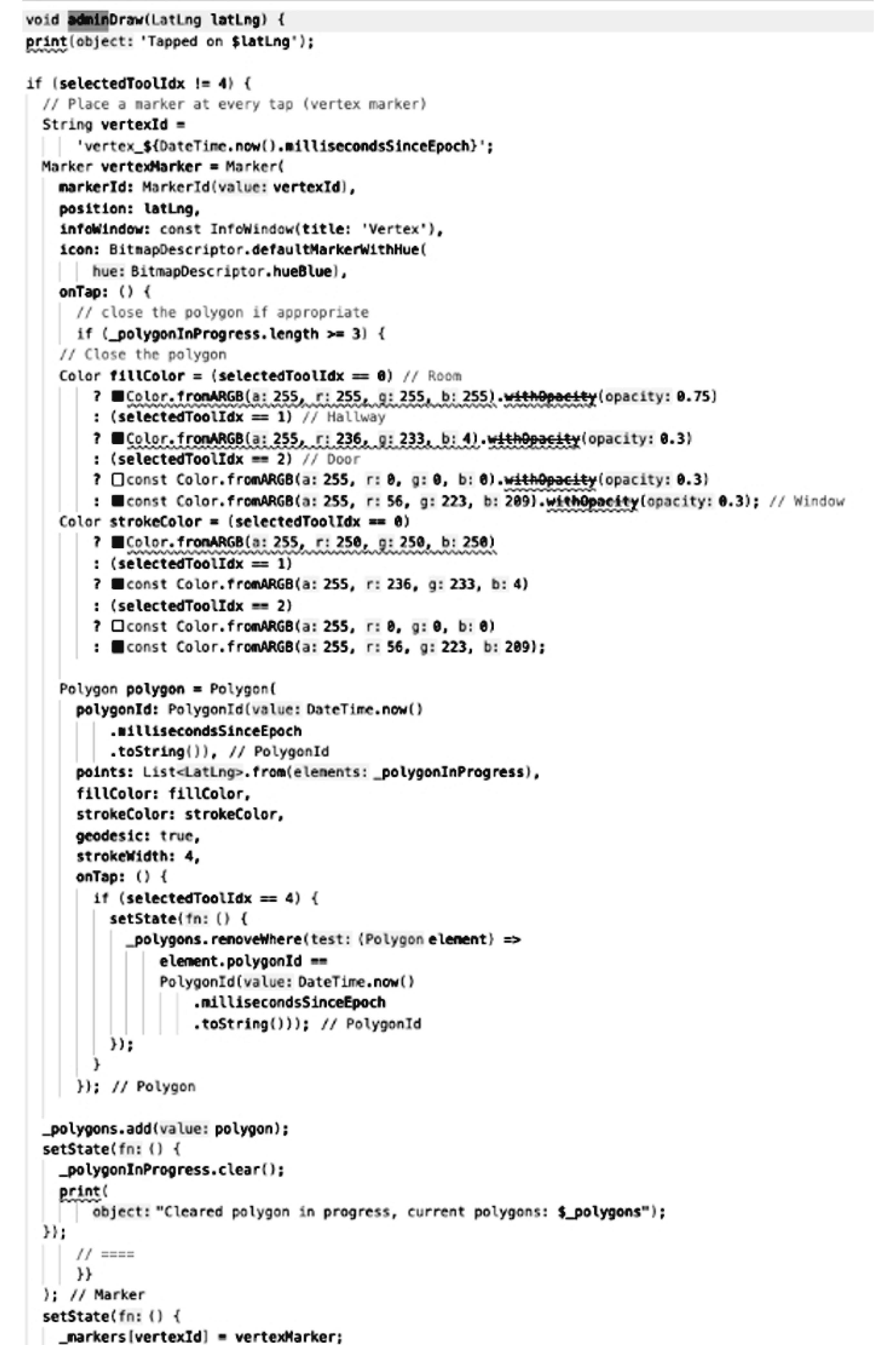
To bring the theoretical model into reality, I developed a working prototype of the GuardianMap app—a real-time emergency response system tailored for school environments. The app uses Firebase authentication, wristwatch GPS tracking, and live map rendering to locate students during emergencies.
I designed and implemented key features, including:
A dynamic floor-mapping tool, allowing administrators to define school layouts and evacuation zones directly on the app.
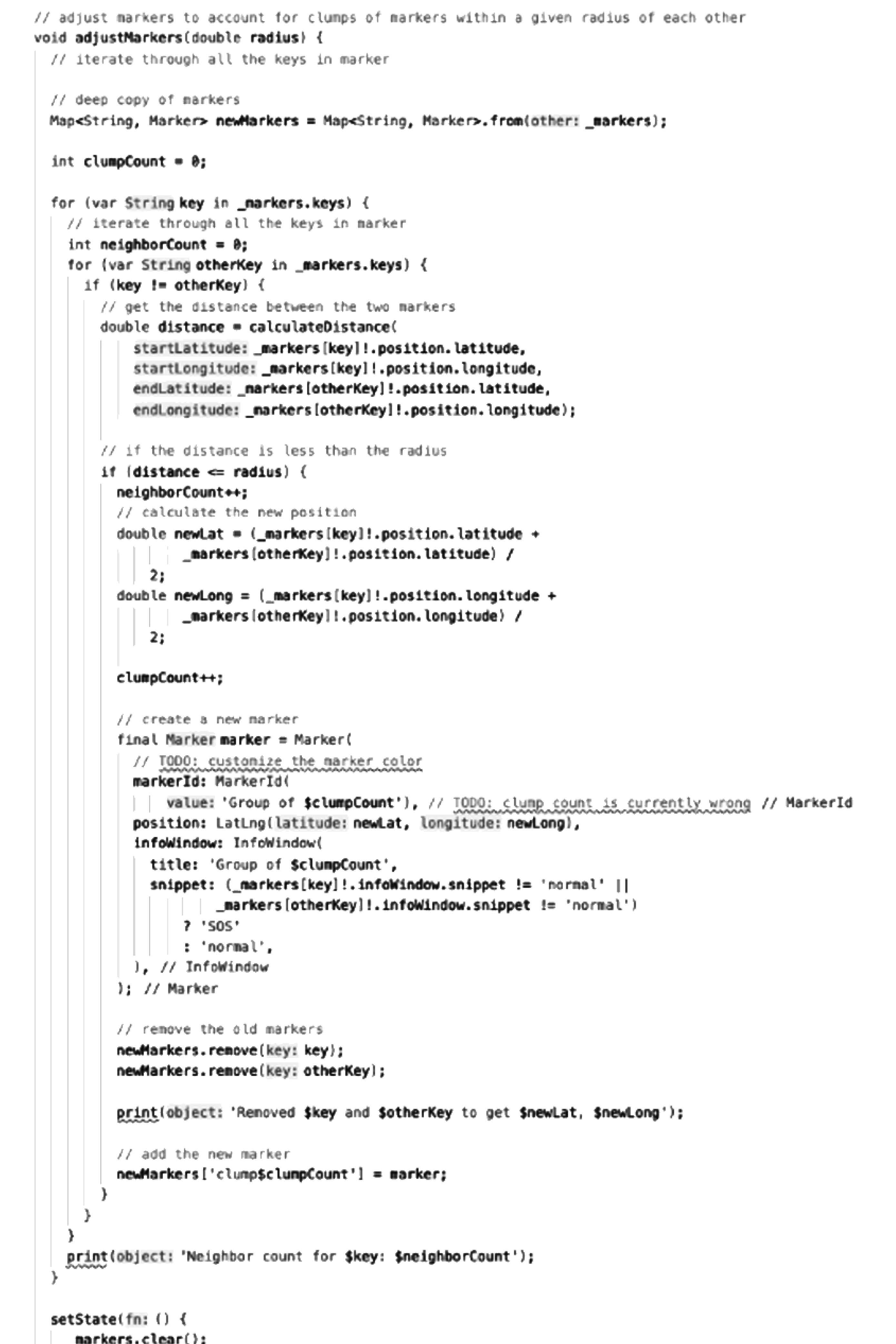
A clustering algorithm to group student locations for clearer visualization.
Real-time alert transmission to authorities, triggered by keyword-based SOS input or wristwatch data.
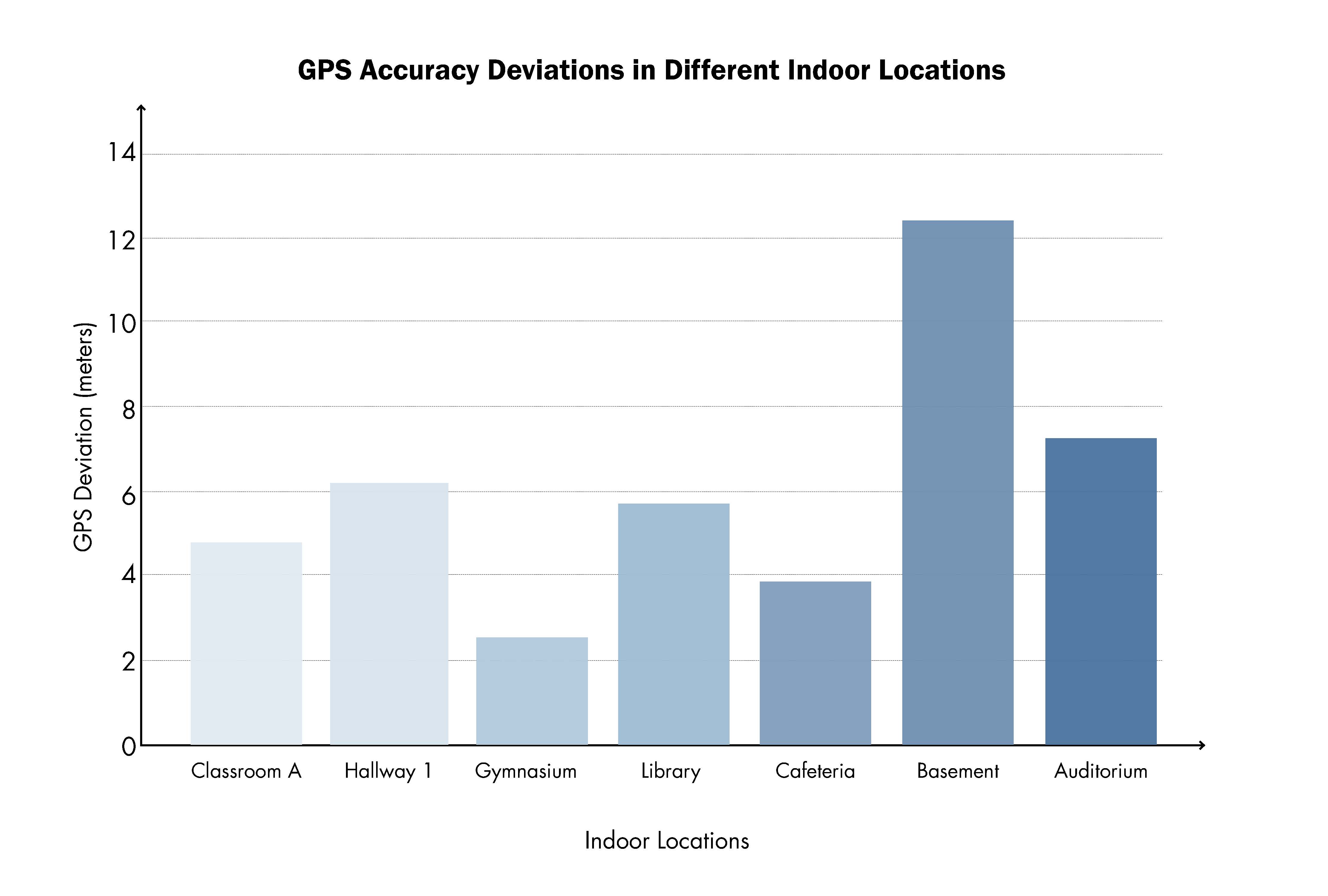
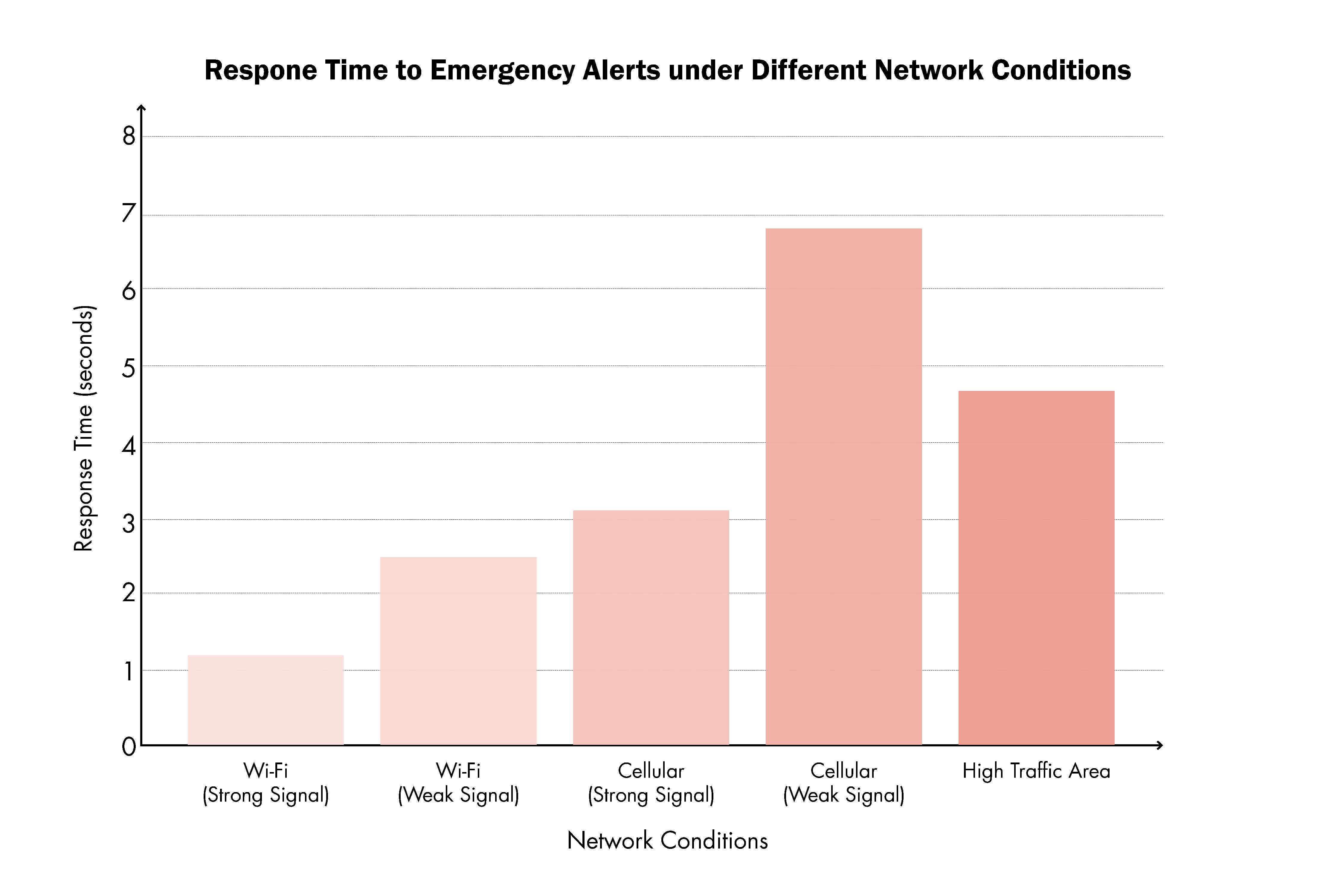
To test the app's robustness, I conducted simulations under different network conditions (Wi-Fi/Cellular, strong/weak signals) and indoor environments. Results showed that response times and GPS accuracy varied significantly, emphasizing the importance of optimizing tech for real-world school infrastructures.
This project taught me how to move from a social concern → to engineering a working prototype. I learned to combine user-centered thinking with technical implementation—turning abstract safety problems into actionable software solutions. I also realized how critical network infrastructure, UX clarity, and privacy considerations are when designing systems for real-world emergencies.